Label Plan
Icon: |
I |
Introduction
The Plan Labels command provides users with access to multiple labelling tools to create labels in the drawing. The Plan Labels command provides added to adding labels to surfaces, alignments, strings and pipe networks.
Plan Labels are intelligent labels with links
to the object that they are created for. Users can create labels with
textual information related to the object they are connected to, and all
labels update whenever the user runs the ![]() Synchronise command, or moves the label (for labels that are built
to be repositioned by the user, such as surface elevation labels)
Synchronise command, or moves the label (for labels that are built
to be repositioned by the user, such as surface elevation labels)
Label Types Explained
| Label Type | Details | Sample |
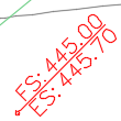
| Surface Elevation and 1 Point Slope Label | Display surface elevations, including cut and fill |  |
| Display instantaneous slope information for a surface |  |
|
| Surface 2 Point Slope Labels | Display AVERAGE slope calculated between two points,
defined by the start and end of a Line element defined in the
style Note: the Line must act as the Marker for this type of application. |
 |
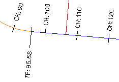
| Alignment Labels | Display alignment labels at select chainage locations (major, minor and geometry) along the alignment |  |
| Alignment Offset Labels | Display alignment chainage and information, calculated at a selected location in the drawing |  |
| String Vertical Geometry Labels | Display string vertical geometry on the plan |  |
| String Code Labels | Display information on plan related to design codes on a String, such as elevation and code |  |
| Pipe Network Labels | Display pipe network information. |   |
Managing Label Display and Editing
The label presentation is managed by the creation and application of Label Styles. These are created and saved in the drawing, each with its own predefined style. The styles created can be used for other projects and stored within the global settings for inclusion in new projects. Label Styles are managed via the Label Styles command for Surface Labels.
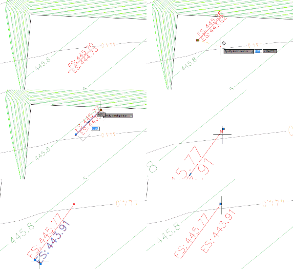
| Grip Editing. Text and Marker (Surface Label example shown) | ||
|
 |
|
|
Moving the marker grip will reposition the entire label and update the Label content if referencing a surface. Use the Sychronise Labels command to update label contents where necessary. |
|
|
Moving the text grips will reposition the Label text only. |
|
| Users can create a Label Style which will generate leaders from the marker to the Label text if the text grip is dragged a specified distance. | ||
.
| Grip Editing. Text associated to Line (Surface Label example shown) |
|
| Text can be associated to a line, with position set relative to the line |
Details
This is where you detail what the command does, how it behaves and what the inputs are. The traditional approach is as follows
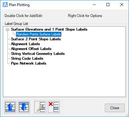
Upon selecting the command the following form is displayed:
|
|
Label Group List |
Lists the different types of labels that can be created. Double click on one of these to create a new Label Group of that type. Selecting a label group will display buttons with options to reorder the groups, edit and delete groups of labels |
Surface Elevations an d1 Point Slope Label |
Details for this label type are covered in Surface Elevations and 1 Point Slope Labels |
Surface 2 Point Slop Labels |
Details for this label type are covered in Surface 2 Point Slope Labels |
Alignment Labels |
Details for this label type are covered in Alignment Labels |
Alignment Offset Labels |
Details for this label type are covered in Alignment Offset Labels |
String Vertical Geometry Labels |
Details for this label type are covered in String Vertical Geometry Labels |
String Code Labels |
Details for this label type are covered in String Code Labels |
Pipe Network Labels |
Details for this label type are covered in Pipe Network Labels |
|
Edit tools for selected label group. Left click, then right click on the label group will provide a similar list of controls. |
Move Up |
Move the selected label group up in the list of group labels of that type |
Move Down |
Move the selected label group down in the list of group labels of that type |
Edit Label Group |
Open the label group for editing |
Delete Label Group |
Deletes the selected label group |
Close |
Close the form |


