Add Labels
Icon:
![]()
Ribbon: Model Viewer > Labels Tab > Labels Panel > Add
Introduction
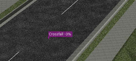
The Add Labels command allows users to add their own labels to Model Viewer. These labels can be used to display general notes or design data. Design data that is added to the label will dynamically update when changes are made to the design. These labels can be styled by the user via the Label Styles command.

Ribbon Tab and Navigation
This command forms part of the following tab:
![]()
Information on navigation in the Model Viewer 3D environment is available when reviewing the Model Viewer command help.
Details
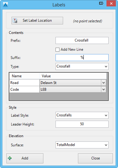
Upon selecting the command the following form is displayed:
|
|
|
|
Set Label Location |
Select this button to specify a location for the new label. The user will be prompted to select a location from the drawing. |
|
Contents |
Allows the user to specify the contents of the label |
|
Prefix |
Type in an optional prefix for the label |
|
Add New Line |
A new line is added to the label between the prefix and suffix. |
|
Suffix |
Type in an optional suffix for the label |
|
Type |
Select the design data to be displayed in the label. The options include: Blank - No design data is added to the label. Chainage - The chainage value of a selected alignment is added. Offset - The offset value of a selected alignment is added. Elevation- The elevation value of a selected surface is added. Level Difference - The level difference value between two selected surfaces is added. Crossfall - The crossfall value of a code on a selected road is added. Two-Point (by Layer) - The software will scan all line entities on the specified layer and report a two-point crossfall label at each line. |
|
Style |
Allows the user to specify a style for the label |
|
Label Style |
Specify the label style that is assigned to the label. Users can customise the style via the Label Styles command. |
| Leader Height |
Set the height of the label leader. This height is measured
from the level calculated from the surface elevation. |
|
Elevation |
Allows the user to specify the surface that is used to
interpolate the elevation the label uses. |
| Surface | Select a surface from the drop-down list |
| Add | The label is added to Model Viewer |
| Close | Exit the command without adding a new label |
The Label List command can be used to edit a user-added label. This command can be accessed via the Labels tab on the ribbon.
