DRAINS Catchments
Icon: ![]()
Menu: Pipes > Create Drainage... >
DRAINS Catchments
Ribbon: Pipes Tab > Drainage Design Panel > Catchment Area
Dropdown > DRAINS Catchments
Introduction
In order to aid in transfer of data between Civil Site Design and DRAINS, the DRAINS Catchment command provides direct input tools for defining a catchment in DRAINS (ILSAX method). Inputs on this form match exactly with DRAINS catchment inputs.
Coefficient of runoff values are included to facilitate calculation of flows in Civil Site Design (utilising the Rational Method).
A symbol will display in the drawing to confirm that a catchment has been added to the selected structure.
For each catchment, DRAINS allows for input of three land area types: Paved, Supplementary and Grassed. Users are required to type in a percentage value applying to each area type, with the total summing to 100%.
Please refer to the Watercome DRAINS help for details on each input in the following form (with exception of the CSD C Factor).
Details
Upon selecting the command and selecting a structure the following form is displayed:
|
|
|||||||||||||||||||
|
Structure Number |
Non editable field describing the selected structure |
||||||||||||||||||
|
Sub Catchment Name |
Type in a name for the catchment | ||||||||||||||||||
|
Area (Ha) |
Type in a total area for the catchment | ||||||||||||||||||
|
|
Allows selection of a closed polyline in the drawing. The catchment area will be calculated directly from the polyline | ||||||||||||||||||
|
|
Command prompt will display for the user to click on screen to create a closed area for the catchment. Press Enter or Esc for the software to close the area and add the area value to the form. | ||||||||||||||||||
|
Input Method |
The user can select the level of detail to include for the catchment | ||||||||||||||||||
|
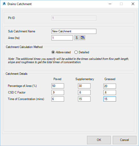
Abbreviated |
Limits the inputs to Percentage of area and Time of Concentration | ||||||||||||||||||
|
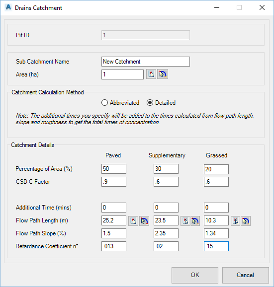
Detailed |
Expands on the inputs, removing Time of Concentration and including additional inputs for the time to be calculated | ||||||||||||||||||
|
Abbreviated Input Method - Inputs |
The following inputs apply to Abbreviated Inputs | ||||||||||||||||||
|
|
|
||||||||||||||||||
|
Detailed Input Method - Inputs |
The following inputs apply to Detailed Inputs | ||||||||||||||||||
|
|
|
||||||||||||||||||
|
OK |
Apply and exit. |
||||||||||||||||||
|
Cancel |
Exit the form without applying any changes. |
||||||||||||||||||